For outdoor enthusiasts seeking adventure without the commitment of lengthy trails, a collection of remarkable small thru-hikes awaits across the United States. These trails, typically ranging from 60 to aournd 300 miles, offer stunning scenery, diverse ecosystems, and the chance to immerse oneself in nature's beauty—all while avoiding the crowds found on more popular routes.
From the rugged peaks of the Toiyabe Crest Trail in Nevada to the lush landscapes of the Lone Star Hiking Trail in Texas, these hikes provide a perfect escape for both seasoned and casual hikers. Whether you're looking for a thru-hike or a multi-day hike, this guide highlights some of the best shorter thru-hikes that promise breathtaking views, rich wildlife, and unforgettable experiences. Grab your gear and hit the trail—adventure awaits!
1) Toiyabe Crest Trail (Nevada) 62 miles / 99.7 km
2) Wonderland Trail (Washington) 93 miles / 149.7 km
3) Lone Star Hiking Trail (Texas) 97 miles / 156.1 km
4) Foothills Trail (South Carolina) 77 miles / 123.9 km
5) Northville Lake Placid Trail (New York) 135 miles / 217.3 km
6) Great Allegheny Passage (Pennsylvania) 152 miles / 244.6 km
7) Tahoe Rim Trail (California) 165 miles / 265.5 km
8) John Muir Trail (California) 215 miles / 346 km
Toiyabe Crest Trail

The Toiyabe Crest Trail (TCT) is a stunning 62-mile trek that winds through the picturesque Toiyabe Range in Nevada. This trail is a hidden gem for outdoor enthusiasts seeking breathtaking landscapes, diverse ecosystems, and a peaceful hiking experience away from the crowds.
Discover the Rugged Beauty of the Toiyabe Crest Trail
| Feature | Details |
|---|---|
| Length | 65 miles |
| Location | Toiyabe National Forest, Nevada |
| Elevation Gain | Approximately 12,000 feet |
| Difficulty | Moderate to challenging |
| Best Time to Hike | Late spring to early fall |
| Trail Type | Thru-hike |
| Permits Required | No permits required |
Highlights of the Toiyabe Crest Trail
- Scenic Beauty: The trail offers a variety of stunning landscapes, from alpine meadows to rugged mountain ridges. Hikers can enjoy sweeping views of the surrounding valleys and unique geological formations.
- Isolation and Solitude: Unlike many popular trails, the Toiyabe Crest Trail sees fewer visitors, providing a serene escape into nature. You’ll often find stretches of the trail where you can immerse yourself in the sounds of nature.
- Varied Terrain: Experience diverse terrains, including lush valleys, rocky outcroppings, and shaded forest paths. This variety keeps the hike engaging and allows for different experiences every day.
Why the Toiyabe Crest Trail Stands Out
- Accessibility: The trail is easily reachable from major cities like Reno and Las Vegas, making it a convenient getaway for those looking to escape urban life.
- Ideal Length: At 62 miles, it’s a manageable hike that can be completed comfortably in 4 to 6 days. This makes it a perfect option for both weekend warriors and more experienced trekkers.
- Flexible Camping: Numerous campsites along the trail provide flexibility for hikers. You can choose to set up camp in tranquil meadows or by bubbling streams, enhancing your overall experience.
- Wildlife Viewing: Keep an eye out for deer, elk, and various bird species. The trail's diverse ecosystems attract a range of wildlife, making it an exciting opportunity for nature lovers and photographers.
Tips for Hiking the Toiyabe Crest Trail
- Plan Ahead: Familiarize yourself with the trail sections and plan your daily mileage according to your experience level and preferences.
- Stay Hydrated: Water sources are available along the trail, but it's wise to carry a water filter or purification method.
- Weather Awareness: Be prepared for changing weather conditions, especially at higher elevations. Pack appropriate layers and gear.
- Leave No Trace: Respect the environment by following Leave No Trace principles, ensuring the beauty of the wilderness is preserved for future hikers.
The Toiyabe Crest Trail is a must-visit for anyone seeking an adventurous hiking experience in a stunning natural setting. Whether you're a seasoned hiker or new to the trail scene, this route offers a unique blend of beauty, solitude, and adventure. So grab your gear, prepare for stunning views, and hit the trail—an unforgettable experience awaits!
Wonderland Trail

The Wonderland Trail is a breathtaking 93-mile loop that encircles the majestic Mount Rainier in Washington State. Renowned for its stunning views, diverse ecosystems, and challenging terrain, this trail offers hikers an unforgettable experience in one of America’s most iconic national parks.
Explore the Majestic Landscapes of the Wonderland Trail
| Feature | Details |
|---|---|
| Length | 93 miles |
| Location | Mount Rainier National Park, Washington |
| Elevation Gain | Approximately 22,000 feet |
| Difficulty | Moderate to strenuous |
| Best Time to Hike | Late July to early September |
| Trail Type | Loop trail |
| Permits Required | Yes, backcountry permits needed |
Highlights of the Wonderland Trail
- Spectacular Scenery: The trail offers breathtaking views of Mount Rainier, glacial lakes, and vibrant alpine meadows. Each section reveals stunning vistas that are perfect for photography and enjoying nature’s beauty.
- Diverse Ecosystems: Hikers will traverse through lush temperate rainforests, rocky alpine terrain, and colorful wildflower-filled meadows. This variety provides a rich opportunity to observe different plant and animal species.
- Challenging Terrain: With significant elevation gain, the Wonderland Trail presents a rewarding challenge for physically fit hikers. The diverse terrain keeps the journey engaging, with ups and downs that offer rewarding views at every turn.
Why the Wonderland Trail Stands Out
- Campsites and Backcountry Experience: The trail features numerous campsites, allowing hikers to immerse themselves in the backcountry experience while enjoying well-maintained facilities. Most campsites are first-come, first-served, so planning ahead is essential.
- Rich Cultural History: The Wonderland Trail holds cultural significance, particularly for Indigenous peoples of the region. Learning about this history adds depth to the hiking experience and connects hikers to the land.
- Wildlife Encounters: The diverse ecosystems attract various wildlife, including deer, black bears, and numerous bird species. Keep your eyes peeled for exciting wildlife sightings along the trail.
Tips for Hiking the Wonderland Trail
- Physical Preparation: Begin training a few months before your hike. Incorporate long hikes, elevation gain, and carrying a pack into your routine to prepare your body.
- Permits: Be aware that obtaining backcountry permits can be competitive. Plan ahead and apply for permits as early as possible.
- Packing Essentials: Carry lightweight gear and don’t forget important items like a water filter, nutritious snacks, a first aid kit, and weather-appropriate clothing.
- Hydration: Water sources are plentiful along the trail, but always have a method to purify your water before drinking.
- Leave No Trace: Follow Leave No Trace principles to protect the park’s natural beauty and preserve it for future generations.
The Wonderland Trail is a premier hiking destination that combines stunning scenery, physical challenge, and rich cultural history. Whether you're captivated by the majestic views or the serene wilderness, this trail promises an unforgettable adventure. So pack your bags, lace up your boots, and get ready to explore one of the most beautiful trails in the United States!
Please note though that permits can be hard to secure.
Lone Star Hiking Trail

The Lone Star Hiking Trail is a captivating 97-mile route that meanders through the beautiful Sam Houston National Forest in Texas. This trail offers a perfect blend of adventure and accessibility, making it one of the best small thru-hikes in the United States.
Immerse Yourself in the Natural Wonders of the Lone Star Hiking Trail
| Feature | Details |
|---|---|
| Length | 97 miles |
| Location | Sam Houston National Forest, Texas |
| Difficulty | Moderate |
| Best Time to Hike | Fall & Spring |
| Trail Type | Loop (with multiple access points) |
| Permits Required | No permits required |
Highlights of the Lone Star Hiking Trail
- Scenic Diversity: The trail showcases a variety of ecosystems, including lush pine forests, vibrant wildflower fields, and serene lakes. Each section offers unique sights and sounds of wildlife, making every hike a new adventure.
- Accessibility: With several access points, hikers can tackle the Lone Star Hiking Trail in sections, making it ideal for both seasoned hikers and beginners. Whether you want a full trek or a simple day hike, it accommodates all preferences.
- Rich History: Along the trail, you’ll encounter historical sites that add an educational layer to your adventure. Learn about the area's cultural heritage as you hike through its storied landscapes.
Why the Lone Star Hiking Trail Stands Out
- Community and Camaraderie: The trail attracts a friendly community of hikers. You’ll often find fellow adventurers sharing stories and tips, creating a sense of camaraderie among those who traverse its paths.
- Peaceful Environment: Unlike many crowded trails, the Lone Star Hiking Trail offers a sense of solitude. It’s perfect for those looking to escape the hustle and bustle of daily life and immerse themselves in nature.
- Well-Marked Path: The trail is well-maintained and marked, making navigation straightforward. Hikers can confidently explore without worrying about getting lost.
Tips for Hiking the Lone Star Hiking Trail
- Plan Your Hike: Decide if you want to tackle the entire trail or enjoy it in sections. Research campsites and water sources along the way.
- Pack Essentials: Bring plenty of water, snacks, a first aid kit, and sturdy hiking boots. Lightweight gear will make your hike more enjoyable.
- Leave No Trace: Follow Leave No Trace principles to protect the environment and keep the trail beautiful for future hikers.
- Stay Safe: Let someone know your hiking plans and consider carrying a map or GPS device for navigation.
The Lone Star Hiking Trail is a treasure within Texas, offering a rich hiking experience that highlights the natural beauty and diverse landscapes of the region. Whether you’re aiming for a quick getaway or planning a longer trek, this trail promises lasting memories. Lace up your boots, grab your pack, and set out on a journey that captures the spirit of adventure!
Foothills Trail

The Foothills Trail is a hidden gem spanning 77 miles through the stunning landscapes of the South Carolina and North Carolina border. This trail offers a mix of adventure and tranquility, making it a fantastic option for both novice and experienced hikers.
Uncover the Hidden Gem of the Foothills Trail
| Feature | Details |
|---|---|
| Length | 77 miles |
| Location | South Carolina and North Carolina |
| Difficulty | Moderate |
| Best Season | Spring and fall |
| Trail Type | Thru-hike |
| Access Points | Multiple trailheads near towns |
Highlights of the Foothills Trail
- Scenic Diversity: Experience a range of ecosystems, from lush forests to rocky hillsides and beautiful wildflower fields. The trail offers breathtaking views and diverse wildlife.
- Waterfalls and Lakes: Hike past numerous waterfalls and pristine lakes, including the stunning Whitewater Falls, one of the tallest waterfalls in the eastern U.S.
- Wildlife Encounters: The trail is home to various wildlife, including deer, turkeys, and numerous bird species. Hikers will appreciate the opportunity for wildlife observation and photography.
Why the Foothills Trail Stands Out
- Less Crowded: Unlike more popular hiking destinations, the Foothills Trail offers a peaceful escape into nature, allowing for solitude and reflection.
- Community Support: The local hiking community is welcoming, providing resources and tips for fellow hikers. There are established campsites along the way for easy multi-day hikes.
- Flexibility: The trail can be tackled in segments or as a continuous hike, making it suitable for both weekend warriors and those looking for a longer adventure.
Tips for Hiking the Foothills Trail
- Plan Your Route: Research campsites and water sources ahead of time to ensure a smooth journey. Some sections are more challenging than others, so choose according to your skill level.
- Pack Smart: Bring plenty of water, snacks, and essential gear. A good pair of hiking boots will enhance your experience on varying terrains.
- Leave No Trace: Respect the environment by following Leave No Trace principles to preserve the trail’s natural beauty.
- Check Weather Conditions: Be prepared for changing weather, especially in the spring and fall. Check forecasts before heading out.
The Foothills Trail provides a unique blend of natural beauty and outdoor adventure, making it a perfect choice for hikers of all skill levels. So lace up your boots, pack your backpack, and set out on a journey through the breathtaking landscapes of the Carolinas!
Northville Lake Placid Trail

The Northville Lake Placid Trail (NPT) is a stunning 135-mile trail that traverses the heart of the Adirondack Park in New York. It connects the towns of Northville and Lake Placid, offering hikers a chance to immerse themselves in the beauty of the Adirondacks, with its dense forests, sparkling lakes, and breathtaking mountain views.
Discover the Adirondack Wilderness on the Northville Lake Placid Trail
| Feature | Details |
|---|---|
| Length | 135 miles |
| Location | Adirondack Park, New York |
| Elevation Gain | Approximately 16,000 feet |
| Difficulty | Moderate to strenuous |
| Best Time to Hike | Late spring to early fall |
| Trail Type | Thru-hike |
| Permits Required | No permits required |
Highlights of the Northville Lake Placid Trail
- Diverse Landscapes: The NPT offers a rich variety of scenery, including deep forests, serene lakes, rugged ridges, and cascading waterfalls. Each section of the trail presents its own unique beauty.
- Lean-tos and Campsites: The trail features numerous lean-tos and campsites, making it easy to plan multi-day hikes without needing to carry a tent. This adds convenience for hikers looking to explore the wilderness.
- Wildlife Viewing: Hikers can encounter a range of wildlife, including deer, black bears, and various bird species. The rich biodiversity of the region makes it a fantastic spot for nature lovers.
Why the Northville Lake Placid Trail Stands Out
- Historical Connection: The trail follows the paths of old railroad lines, giving hikers a glimpse into the region's history. This connection to the past adds depth to the hiking experience.
- Remote Wilderness: Many sections of the trail are remote and less traveled, offering a true wilderness experience. Hikers can enjoy solitude and peace away from busy trails.
- Convenient Resupply Points: Towns along the route provide convenient spots for resupplying, making it easier to complete the trail over several days or weeks.
Tips for Hiking the Northville Lake Placid Trail
- Plan Your Itinerary: Many hikers complete the trail in 10 days to 2 weeks, depending on their pace. Research the trail sections and plan your daily mileage accordingly.
- Be Prepared for Weather: Weather in the Adirondacks can change rapidly. Be sure to check forecasts and pack accordingly with extra layers and rain gear.
- Stay Hydrated: Water sources are available along the trail, but always carry a method to filter or purify your water.
- Leave No Trace: Respect the environment by following Leave No Trace principles to keep the wilderness pristine for future generations.
The Northville Lake Placid Trail is a beautiful journey through one of New York's most stunning natural areas. Whether you’re an experienced hiker or a newcomer to long-distance hiking, this trail offers a memorable adventure filled with breathtaking scenery and a deep connection to nature.
Great Allegheny Passage

The Great Allegheny Passage (GAP) is a scenic 152-mile trail that connects Pittsburgh, Pennsylvania, to Cumberland, Maryland. This trail follows former railroad lines and offers a unique blend of history, natural beauty, and outdoor recreation, making it one of the best small thru-hikes in the United States.
Explore History and Natural Beauty on the Great Allegheny Passage
| Feature | Details |
|---|---|
| Length | 152 miles |
| Location | Pennsylvania and Maryland |
| Elevation Gain | Approximately 10,000 feet |
| Difficulty | Easy to moderate |
| Best Time to Hike | Spring to fall |
| Trail Type | Point-to-point |
| Permits Required | No permits required |
Highlights of the Great Allegheny Passage
- Historical Significance: The GAP is built on old railroad beds, giving hikers a glimpse into the region's industrial past. Historic towns along the route offer opportunities to explore local history.
- Natural Beauty: Enjoy stunning views of deep valleys, rolling hills, and the Youghiogheny River. The trail showcases diverse ecosystems, from lush forests to open meadows.
- Wildlife Viewing: Keep an eye out for various species of birds, deer, and other wildlife. The trail is a great spot for nature enthusiasts and photographers.
Why the Great Allegheny Passage Stands Out
- Accessible Terrain: The trail's gentle grade makes it ideal for hikers of all skill levels, families, and cyclists. It's perfect for those new to long-distance hiking.
- Camping and Lodging Options: Numerous campgrounds and lodging options are available along the route, allowing for flexible planning. You can easily resupply in nearby towns.
- Multi-Use Trail: The GAP is not just for hiking; it's also popular for cycling. The crushed stone surface is perfect for bikepacking, adding another layer of adventure.
Tips for Hiking the Great Allegheny Passage
- Plan Your Sections: Consider hiking the trail in sections if you can’t commit to the entire length. There are many access points along the route.
- Stay Hydrated: Water sources can be found, but it's good to carry extra water, especially in warmer months.
- Check Local Events: Towns along the trail often host events and festivals. Planning your hike around these can add to your experience.
- Safety First: Although the trail is well-maintained, always let someone know your plans and carry a map or GPS device.
The Great Allegheny Passage offers a unique hiking experience filled with history and natural beauty. Whether you’re biking or hiking, this trail is sure to provide a memorable adventure!
Tahoe Rim Trail
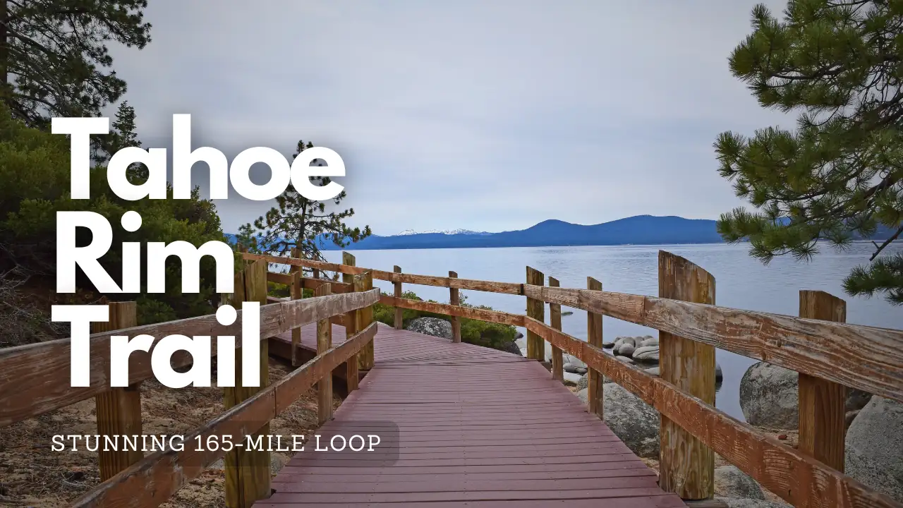
The Tahoe Rim Trail (TRT) is a stunning 165-mile loop around Lake Tahoe, offering breathtaking views of the lake, mountains, and diverse ecosystems. It is perfect for hikers looking for a multi-day adventure in one of the most beautiful regions of the Sierra Nevada.
Witness the Breathtaking Landscapes of the Tahoe Rim Trail
| Feature | Details |
|---|---|
| Length | 165 miles |
| Location | Lake Tahoe Basin, California/Nevada |
| Elevation Gain | Approximately 30,000 feet |
| Difficulty | Moderate to strenuous |
| Best Time to Hike | July to September |
| Trail Type | Loop trail |
| Permits Required | No permits required, but overnight camping requires reservations at certain sites |
Highlights of the Tahoe Rim Trail
- Scenic Views: The trail offers panoramic views of Lake Tahoe, the surrounding mountains, and lush forests. Key viewpoints include Mount Rose, Brockway Summit, and many overlooks along the trail.
- Diverse Ecosystems: Hikers will pass through varying terrains, including alpine meadows, dense forests, and rocky ridges, showcasing the region's rich biodiversity.
- Wildlife Viewing: Look for deer, coyotes, and numerous bird species. The TRT is also home to unique plant life, including wildflowers in spring and summer.
Why the Tahoe Rim Trail Stands Out
- Accessibility: The trail is easily accessible from several trailheads, allowing hikers to enjoy day hikes or the entire loop.
- Well-Marked Trail: The TRT is well-maintained and clearly marked, making navigation straightforward for hikers of all experience levels.
- Flexible Camping Options: There are numerous designated camping sites along the trail, allowing for flexible planning. Many sites offer stunning views of the lake and surrounding scenery.
Tips for Hiking the Tahoe Rim Trail
- Check Weather Conditions: The weather can change rapidly in the Sierra Nevada, so be prepared for varying conditions and pack accordingly.
- Plan Your Itinerary: Most hikers take about 7 to 10 days to complete the trail. Consider your fitness level when planning daily mileage.
- Stay Hydrated: Water sources are available along the trail, but it's a good idea to carry a water filter or purification tablets.
- Pack Essentials: Bring lightweight gear, food, and a first aid kit. Make sure to have appropriate clothing for changing weather conditions.
The Tahoe Rim Trail offers a remarkable blend of natural beauty and outdoor adventure. Whether you're hiking for a few days or just enjoying a day trip, this trail is sure to create unforgettable memories. So lace up your boots, grab your pack, and get ready to explore the stunning landscapes around Lake Tahoe!
John Muir Trail
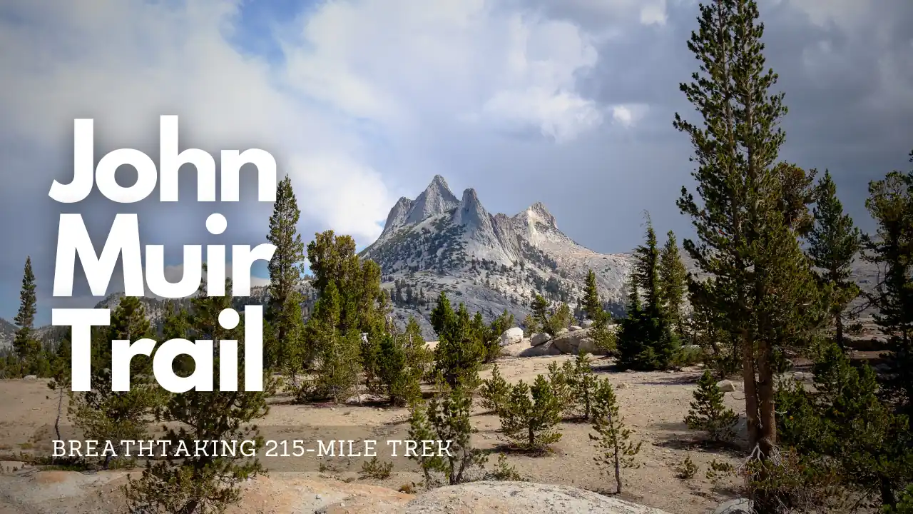
The John Muir Trail (JMT) is a breathtaking 215-mile trek through California's Sierra Nevada mountains. Known for its stunning scenery and rich natural diversity, the JMT takes you through some of the most beautiful landscapes in the United States, including Yosemite, Kings Canyon, and Sequoia National Parks.
Challenge Yourself on the Iconic John Muir Trail
| Feature | Details |
|---|---|
| Length | 215 miles |
| Location | Sierra Nevada, California |
| Elevation Gain | Approximately 47,000 feet |
| Difficulty | Strenuous |
| Best Time to Hike | July to September |
| Trail Type | Point-to-point |
| Permits Required | Yes, wilderness permits needed |
Highlights of the John Muir Trail
- Iconic Landscapes: Experience stunning views of granite cliffs, alpine lakes, and wildflower meadows. Key highlights include Half Dome, Yosemite Valley, and Mount Whitney, the highest peak in the contiguous U.S.
- Wildlife Viewing: Keep an eye out for black bears, mule deer, and a variety of bird species. The diverse ecosystems along the trail are home to many animals.
- Diverse Ecosystems: From lush valleys to rugged mountain passes, the JMT showcases the rich biodiversity of the Sierra Nevada.
Why the John Muir Trail Stands Out
- Challenging Terrain: With significant elevation gains and varying weather conditions, the JMT is perfect for experienced hikers looking for a challenge.
- Camping Options: Numerous backcountry campsites along the trail allow for flexible planning. Popular sites include Tuolumne Meadows and the area around Lake Topsy.
- Cultural History: The trail is named after naturalist John Muir, whose advocacy for the preservation of wilderness helped establish national parks. Exploring this trail provides insight into the natural history and conservation efforts of the region.
Tips for Hiking the John Muir Trail
- Prepare Physically: Train in advance, focusing on endurance and elevation gains to get ready for the challenges ahead.
- Plan Your Itinerary: Most hikers take about 2 to 4 weeks to complete the trail. Plan daily mileage based on your skill level and experience.
- Stay Hydrated: Water sources are plentiful, but always have a method to purify water, as some may be contaminated.
- Leave No Trace: Respect the environment by following Leave No Trace principles to preserve the beauty of the wilderness for future generations.
The John Muir Trail is a must-hike for anyone seeking an unforgettable outdoor adventure. With its stunning scenery and rich biodiversity, this trail promises to leave you with lasting memories. So pack your gear and get ready to explore the majestic Sierra Nevada!


